
BIOMAC participants: Yifang Shi, Harry Seijmonsbergen and W. Daniel Kissling
Recent developments in active remote sensing, particularly the light detection and ranging (LiDAR) technique, has shown great potential for ecosystem structure monitoring due to its capability of capturing three-dimensional (3D) information of vegetation. Using LiDAR-derived metrics, our research is mainly focusing on biodiversity monitoring, mapping of animal habitats, and ecosystem structure change detection.
Airborne laser scanning (ALS) surveys have been conducted by an increasing number of countries as national monitoring programs, providing high-resolution, multi-terabyte 3D point clouds at (super-)national extents. Together with the Netherlands eScience Center, we have developed a free and open-source point cloud processing library (‘Laserchicken’) embedded in a High Performance Computing (HPC) workflow (‘Laserfarm’) to enable the efficient, scalable and distributed processing of large amount of country-wide airborne LiDAR data. This research is part of our eEcoLiDAR project (eScience infrastructure for Ecological applications of LiDAR point clouds).
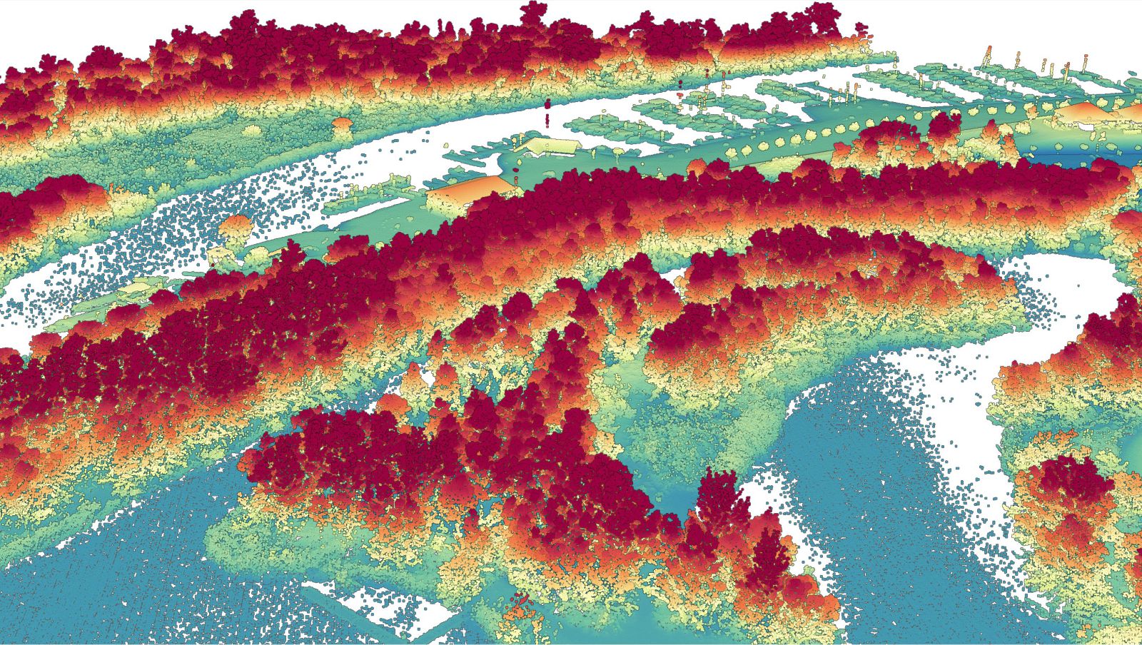
Examples of 3D point cloud (colored by elevation) derived from airborne LiDAR:
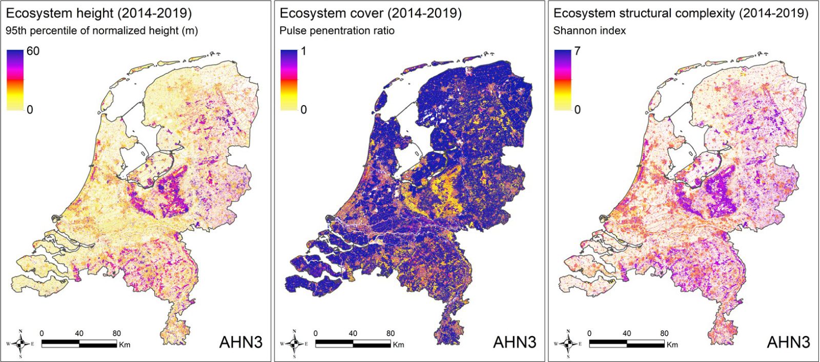
Examples of generated data products of ecosystem structure from airborne LiDAR (i.e. AHN3) across the Netherlands:
Some of our ongoing work related to airborne LiDAR:
Previous work related to airborne LiDAR can be found under publications.
We use a hand-held LiDAR system (ZEB-Rovo) to generate detailed 3D point clouds at 40.000 point/sec, which are collected in various field locations. Such information can be used to calculate detailed metrics, e.g. to extract forest information on the distribution and volume of dead wood, understory structure, horizontal and vertical vegetation structure and measures of the diameter at breast height.
Ongoing work is taking place in the nature reserve Oostvaardersplassen in cooperation with the Dutch Forestry Organization (Staatsbosbeheer), where we develop methods to estimate above-ground biomass of grasslands in grazed and non-grazed plots. For that, we correlate laboratory analyses of grassland biomass samples with metrics from 3D point cloud samples, and use Object-Based Image Analyses (OBIA) and Random Forest and Linear Regression Models to map the spatial distribution of biomass.
BIOMAC contact
Dr. W.D. (Daniel) Kissling
Email: wdkissling@gmail.com
Phone: +31 (0)20 525 8423
Postal address
Institute for Biodiversity and Ecosystem Dynamics (IBED)
P.O. Box 94248, 1090 GE Amsterdam
The Netherlands